As mentioned in a previous post there were two main trails over the mountains to the interior of Canada. The small community of Dyea was located near the Chilkoot Trail at an inlet from the gulf. In the summer and winter of 1897 and 1898 the population grew to over 5000 as ship after ship docked with passengers. The town of Dyea shrank to around 250 by 1900 after the railroad was competed through White Pass. Who wants to hike over mountains and wilderness carrying a heavy pack when they can ride a train. Yesterday afternoon we drove the mostly dirt and gravel road over to the former location of Dyea. There is absolutely nothing remaing of the town and the location is part of the Klondike Gold Rush National Park.
The once bustling harbor of Dyea is now land. An interesting fact we learned from one of the signs is that through the process of plate tectonics and isostatic rebound, the land here is rising at the rate of 3/4 of an inch each year.
Flats where Dyea harbor once was
There are many wild Irises in the area where the town was located.
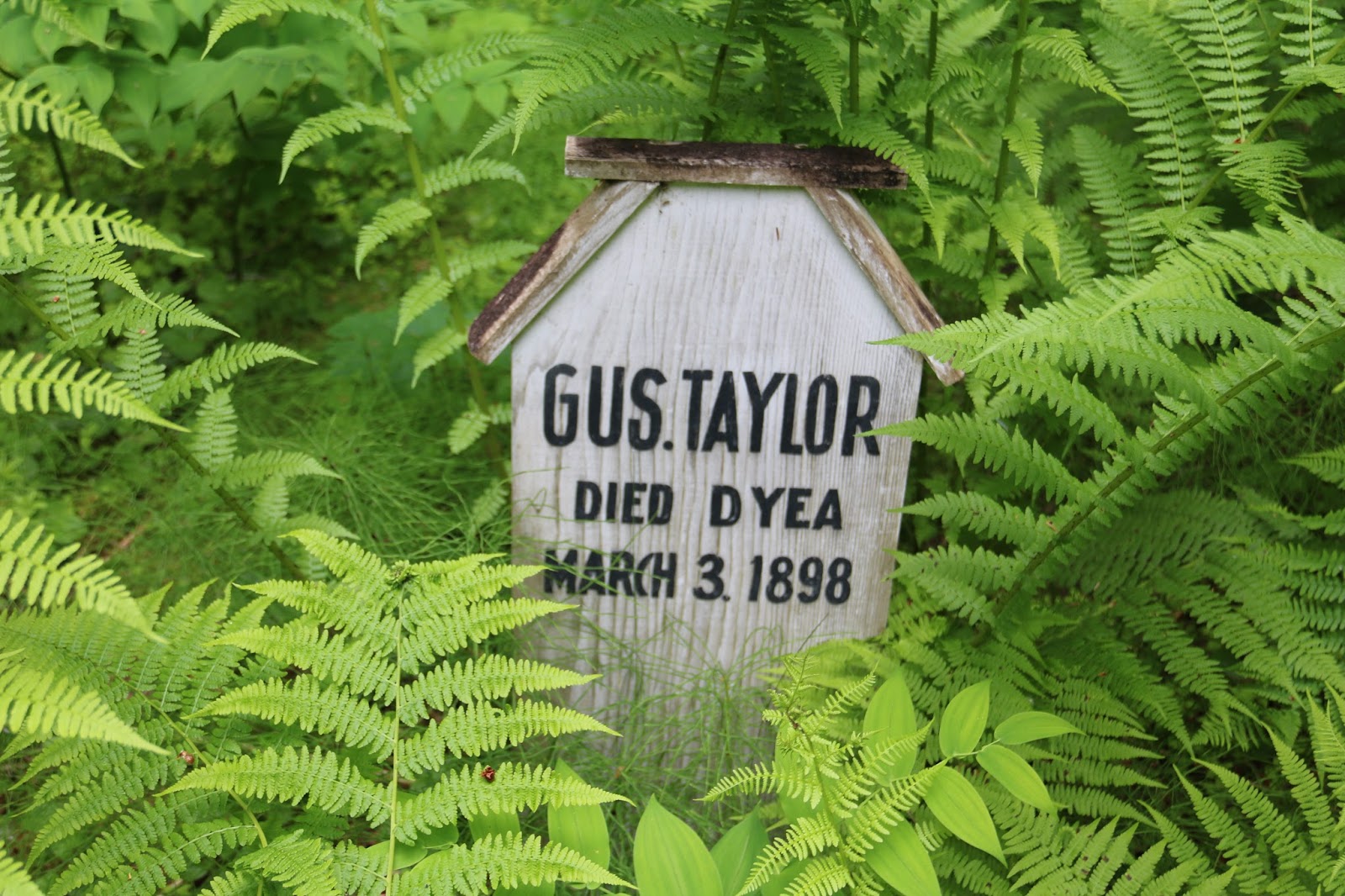
Not far from the town location was and old cemetery. We attempted to visit the cemetery but took very few photos because that location was guarded by mosquitoes. They were large and blood thirsty so we quickly moved on.
Needs no explanation
An example of the thick growth at the cemetery site
Old grave marker
Today we move over to Haines Alaska via the ferry. We are a little nervous about the ferry. We have put cars on a ferry several times but never a large motorhome. The plan is to stay two nights in Haines and then take the Haines Highway back into Canada intersecting with the Alaska Highway. From there we will continue our travels back to Alaska and the first major town of Tok.


No comments:
Post a Comment