Thursday, May 31, 2018

Avenue of the Giants

When we were at Sequoia National Park we mentioned the difference between the Giant Redwoods and the Sequoia trees and that we would be touring the Avenue of the Giants soon. Yesterday we spent most of the day taking in the various points of interest up and down that old stretch of Highway 101. Once the redwood trees were cut down like they were an inexhaustible resource but round 1917 efforts were begun to protect and preserve these ancient trees. In 1921 the Humboldt Redwoods State Park was established containing the world's largest old growth of coast redwoods. The old Highway 101 meanders through the forest of giant redwoods and today is known as the "Avenue of the Giants".  Many of those trees are over 2000 years old and a drive on the Avenue can may you feel you are in an ancient mystical land. In this forest grows the tallest living organisms in the world and one tree discovered in 2006 was measured at 379.7 feet tall.


Driving the Avenue of the Giants


Big tree or little man?

Would not want to be around when that tree fell

Now that is tall

Almost the entire route of the Avenue of the Giants meanders next to the Eel River. There are locations that allow a vehicle, four wheel drive recommended,  to drive down to the river. We did that at one location.

The Eel River

Another attraction is an old redwood tree that you can drive thru if you are so inclined. It was tight because the passenger side mirror grazed the tree as I drove thru.

The Devil made me do it! 


The following photo is a section of a redwood tree on display at the visitor center that fell on December 26, 2006. The beginning ring, not marked in the photo, is from 912 AD, making the tree 1094 years old when it crashed to the ground. The first marker near the center is 1000 AD when the Vikings discovered North America and the last marker going out is 1928 when the California State Park System was established.

Growth rings marked


Another interesting object on display at the visitor center was a camper/motorhome hewn from a section of a redwood tree and mounted on a Nash Quad truck. Charles Kellogg, who was born in the area, was concerned about the destruction of the redwood forests and built the Travel-Log as a publicity stunt. He drove the Travel-Log to other parts of the county so people could see first hand the size of the big trees. He started work on the project in 1917 from a fallen redwood giant found in the nearby forests. He was an interesting man and could duplicate the sounds of birds with his vocal cords. He learned to make the sounds as a boy and eventually became a vaudeville celebrity known for his mastery of bird calls. Below are two links on the Travel-Log and the Nash Quad truck.

https://www.roadsideamerica.com/story/21008

https://en.wikipedia.org/wiki/Jeffery_Quad

Travel-Log

A look inside

It had a sink and toilet


Monday, May 28, 2018

Alcatraz

Yesterday we took a tour of Alcatraz Island. It was Sunday slap dab in the middle of the Memorial Day weekend and the crowds and traffic were heavy. The parking garage cost us $20 for the day and after the tour we looked for a nice place to eat. Settled on a place across the street from the pier and had a $21 cheeseburger with fries. It was good and very thick, as it should be for $21.


Leaving San Francisco behind

Closing in on Alcatraz Island

The prison is the large building at the top of the island


Following the acquisition of California, the US Army began fortifying Alcatraz Island and by 1853 were guarding the harbor from Camp Alcatraz. At the height of the Civil War the island held over 100 heavy cannon ranging in size from 8 inch to 15 inch. The 15 inch gun weighted 50,000 pounds and could fire a 440 pound cannonball three miles.

One of the 10 inch cannons

The island is just a huge rock and had no soil. The army wives living on the island complained of not having soil for a garden so soil was transported from nearby Angel Island. Today there is a lot of vegetation on the island thanks to that soil.

Lots of vegetation today

In August 1934 the island became a federal prison and remained one until it was closed in 1963. On two different occasions the abandoned island was occupied by a group of Native Americans demonstrating against government polices toward Native Americans. The following photo of the water tank shows some of the graffiti left behind during the occupations.

Notice graffiti on water tank
 
The inmates of Alcatraz were allowed two showers a week and this photo shows the showers. Puts me in mind of my early days in the military where modesty had to be abandoned. I hated the row of toilets without any partition between seats.

Notice all the shower heads

A typical cell

One of the cell blocks

The old mess hass

In the photo of the old mess hall you may notice one of the devices in the next photo. There were many of these on the ceiling and they were tear gas canisters that were remotely controlled. They were never used.

One of many tear gas canisters

Mess hall menu 

The old prison control room

As a Federal Prison Alcatraz was designed to hold prisoners who continuously caused trouble at other federal prisons. During its operation Alcatraz held some of the most notorious criminals in American history. To name a few, Al Capone, Robert Stroud (Birdman) and George "Machine Gun" Kelly.

Some of the famous inmates

There were numerous escape attempts from Alcatraz but only one may have been successful. Two brothers, Clarence and John Anglin, and Frank Morris spent at least a year planning and preparing for their escape. A fourth prisoner who was left behind because he was not ready was interviewed by the FBI to obtain many of the details of how the three escaped. The FBI maintains they drowned and were not successful but none of the three bodies have ever been found. If you google the escape you will find lots of interesting material to read. They fashioned a make shift raft out of raincoats. Here is the wikipedia link:
https://en.wikipedia.org/wiki/June_1962_Alcatraz_escape_attempt#Escape


In 1972 Alcatraz became part of the National Park System and today has over a million visitors each year. We noticed many of the visitors were from foreign countries and were surprised they would be interested in a retired US Federal Prison.


Saturday, May 26, 2018

Napa Valley

Yesterday, Friday, it was off to Napa Valley and a tour of Castello di Amorosa, an authentically built 13th century Tuscan castle complete with a torture chamber. All the stone is from old castles and was shipped from Europe. It cost a total of $75 million to build this winery and it is the pet project of 4th generation vintner Dario Sattui. Here are two links about this winery.

https://en.wikipedia.org/wiki/Castello_di_Amorosa

http://www.castellodiamorosa.com/

Two photos of the surrounding vineyards.

Looking down the hill

Looking up the hill


In the courtyard


 The following photo is in the elaborate dinning hall. Dario hired two brothers from Italy to paint the walls and they spent 11 years completing the work. Just one reason it cost $75 million to build the place.

The dinning hall

A closer look at the wall

One of the many areas below

More wine stored below

300 year old Iron Maiden in torture chamber

How is this for a easy chair


The Golden Gate and Muir Beach

Thursday we drove down to San Francisco and the pier area. We needed to locate a good parking lot for Sunday when we will take a tour of Alcatraz and the bay. We first went up to the vista points for the Golden Gate bridge and took some photos. It was not a good day for photos because it was overcast and fog sometimes rolled in from the coast. Sunday is forecast to be sunny and warmer so perhaps we will try again when we are down there.

The Golden Gate Bridge welcomes ships into the bay

The city viewed thru the bridge


After driving around town and the pier area we drove back across the bridge and exited into the vista point at the north end of the bridge. We took a few photos and then walked midway across the bridge. The foot traffic and bike traffic was very heavy and we were lucky to avoided being ran over by a bicycle. Would be interesting to know how often someone is hit by a bicycle on the bridge. There are signs directing pedestrians to stay to the outside railing and bikes to stay to the inside railing but that is near impossible with the large number of pedestrians traveling in both directions. Most of the bikes were rental and many of the users were not skilled bikers. The city needs to require all bikes be walked across the bridge. We did see a police officer on a bike patrolling the bridge.

Look at the traffic on the bridge

In the photo below look at the two bikers on the left whizzing by the pedestrians on the right.

Cars, bikes, and people

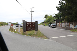
After leaving the Golden Gate bridge we drove up 101 a few miles and turned off onto California 1 that runs along the coast. First stop was a Subway in Tamalpais Valley Junction to ad some fuel to our hungry bodies and then on out to Muir Beach. Dogs were allowed on the beach so Bo got to stretch his legs and go for a walk. He loved the beach and jealously eyed another dog who's owner allowed to frolic in the water. Bo is a royal and we will have none of that! Some of you are saying we are cruel not to let him play in the water but if you had to deal with all the sand sticking to his coat you would understand. Giving Bo a bath is not high on our list of things we like to do.

Sign welcoming us to the beach


Bo loves the beach and the feel of the sand


Muir Beach

After the beach area we drove up to Muir Beach Overlook with a fantastic view of the coast line. There are a number of old World War II gun emplacements there were soldiers monitored the entrance to the bay.

One of several gun emplacements at the overlook


The Northern California Coast is beautiful but treacherous to both humans and watercraft. Beaches are rare along this part of the coast making Muir Beach a popular destination.

View of the coast looking north

In the photo below Muir Beach can be seen down below in the left and the entrance to the bay and the Golden Gate is in the center of the photo. As far as one can see in both directions there is only one beach.

View of the coast looking south


On the road to Pelaluma

Wednesday morning we left Lemon Cove and the Central Valley and made our way to San Francisco and the bay area. As you would expect traffic was heavy and sometimes slow. The best route to Petaluma, where our campground is located, was on I-580 crossing the bay via the Richmond Bridge. Seems all bridges in the bay area are toll and neither of our two automatic toll transponders worked for the bridge. We went thru the cash lane and had a shock when the attendant said $20. Because we were towing our car he considered us to be four axles. What a rip off! The Golden Gate bridge has photo toll via license plates and we expect to receive a few bills from that bridge. One of the reasons traffic is so congested in the bay area is a significant portion of the traffic must use one of the seven main bay bridges. We are 35 miles north of the Golden Gate bridge and yet CA 101, the highway that crosses the bridge, will back up during busy times. You lean to allow plenty of time to reach your destination and throw the calculated times by Google Maps and your GPS out the window. Brings to mind the old saying, "nice place to visit but I wouldn't want to live here".

 They say California is broke and the roads indicate the state is way behind on maintenance. Some of the worst roads we have traveled on are here in California. When they do patch the roads they just pile up the asphalt to form a bump and you get stretches of road that are like driving on a wash board. Besides the roads, another political hot button here is water. Driving up I-5 thru the Central Valley you see all manner of signs relating to the water shortage. California is a huge agricultural state with vast fields of crops but two thirds of the state appear to be desert. All thru the Central Valley you will see canals carrying water and every field has a means of irrigation. The recent drought years have resulted in water rationing and the farmers are not happy.
After traveling all day we are tired and decide to remain in the campground after we arrive in Petaluma.

Wednesday, May 23, 2018

Kings Canyon and Grants Grove

Yesterday we drove up to Kings Canyon National Park situated just north of Sequoia National Forest. Kings Canyon is said to be the deepest canyon in the United States at over a mile and a half deep but the visual impact cannot compare to the Grand Canyon. The Grand Canyon, with its steep walls and huge ditch like appearance, will take your breath away. If you have never seen the Grand Canyon then you need to put that on your bucket list. In the photo below you can see the Kings River at the canyon floor.

Kings Canyon viewed from Junction View

Closer view of Kings River


The road down into the canyon

The King Canyon Visitor Center is located at Grant Grove which contains many large Sequoia trees, one of them being the General Grant Tree. Not as large and old as the General Sherman Tree, but still impressive. The Grant Grove appeared to have better growing conditions than the Giant Forest Grove where the Sherman Tree is located. The Grant Tree is almost as large as the Sherman Tree but only 1700 years old. There were many large Sequoia trees in this grove. Here are a few photos.

Parking lot at the Grant Tree

Look how small the bus looks next to these trees


The Sequoia resists decay and can last for hundreds of years lying on the forest floor. The fallen tree and the live tree behind the horse in this photo are the same ones in the next photo I took yesterday. The photo in the sign wan taken in 1900.


Enlarge the photo of the sign below and read it. Seems Easterners did not believe the the huge trees existed.


The small tree in the center of the photo  below is a young Sequoia. Without the guidance of a nearby sign we would not have known this was a Sequoia tree.


Time to break camp and move to the San Francisco bay area.